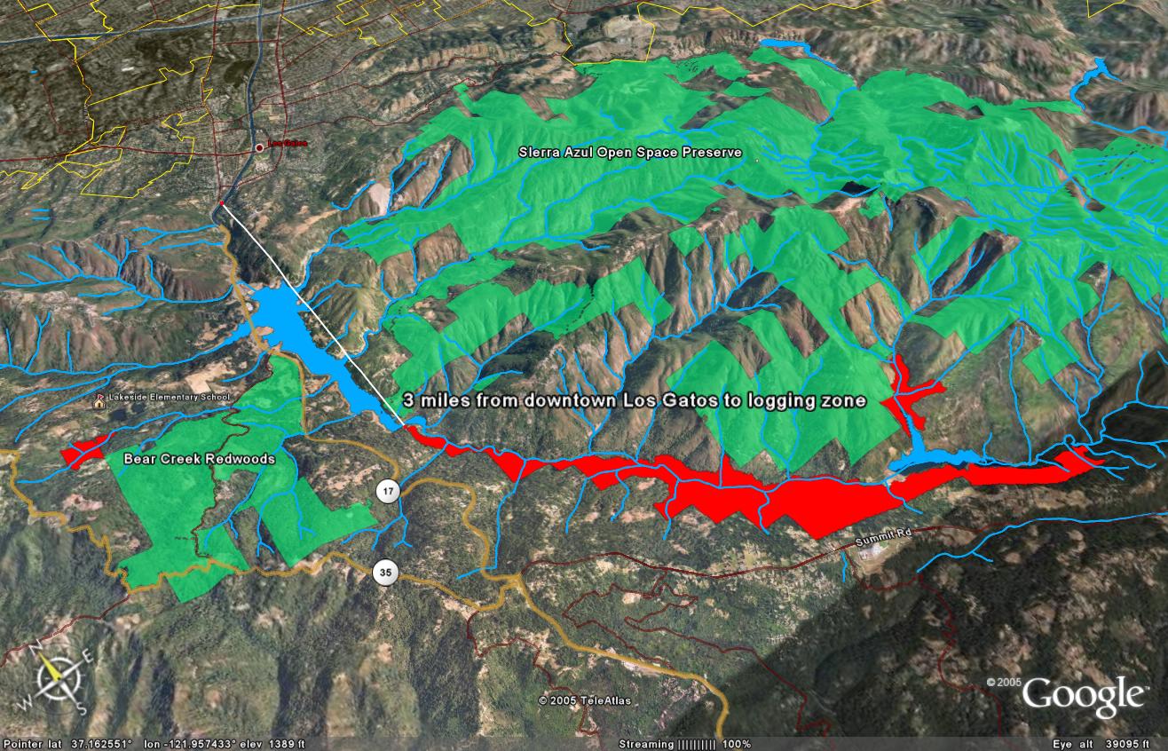
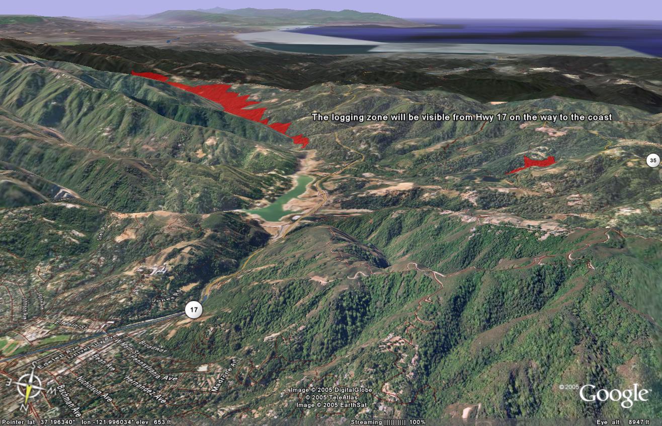
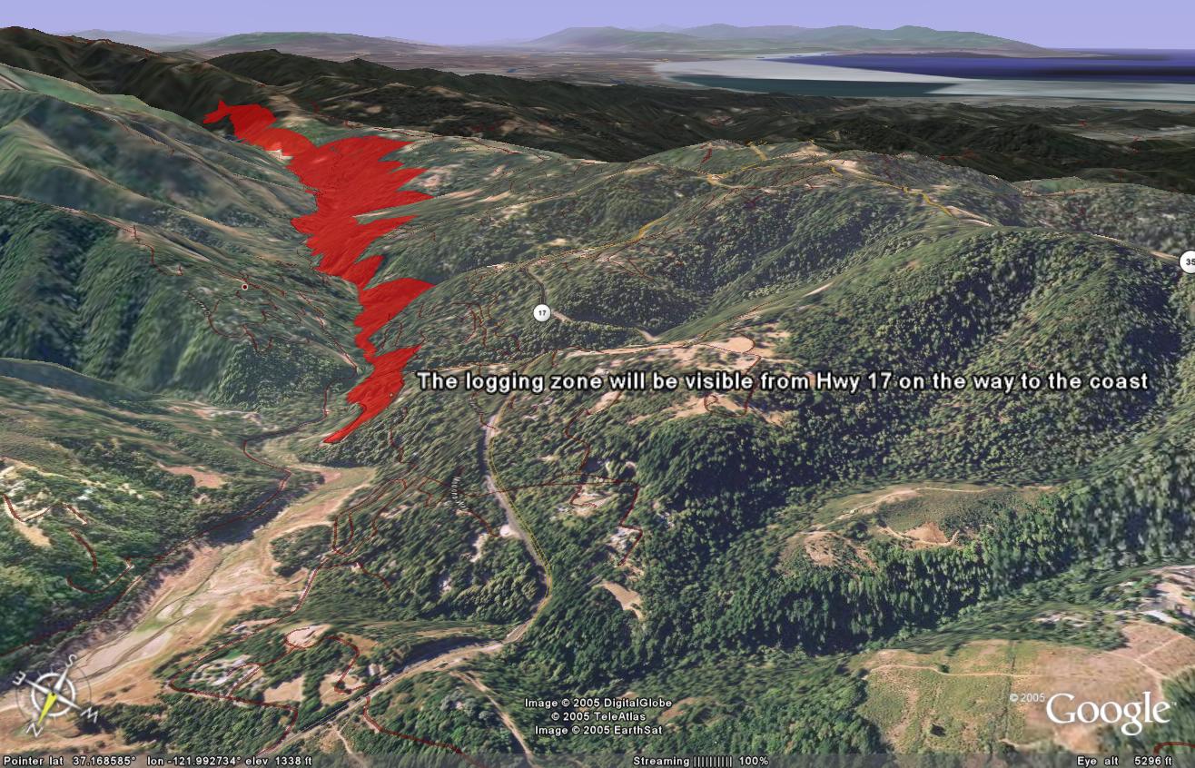
Screen shots of Logging Zones
Attached are several interesting Google Earth screen shots of the logging proposal. On several of these, I've noted the distance from the town of Los Gatos to the proposed logging zones.
As you open each of these images, remember to use the "Back" button on your browser to return to this page, in order to view the rest of the images.
Also, if you try using Google Earth (see <a href="node/52">earlier post</a>), you can easily create these types of screenshots yourself. Just select "Save Image" from the Google Earth "File" menu.
Rebecca
September 18, 2005